Jau National Park is the largest national park in the Amazon Basin, situated around 200km north-west of Manaus. It’s a fragile ecosystem that could be easily destroyed or preserved, however people want to be exploit it for its resources.
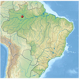
Location Map of Jau National Park, Brazil
Ecosystem:
Jau has a humid, tropical climate with two rain seasons: July to September and December to April. The average annual temperature range is 26°C to 26.7°C. As a result, there is a great deal of diversity with 120 mammal species, 470 bird species (2/3rd of the birds recorded in the Amazon), 15 reptiles and 320 fish.
There are three main vegetation types (micro-habitats):
· Dense Tropical Forest: mainly unflooded land with stratified layers including tall emergent trees. Average of 180 species per hectare.
· Open Tropical Igapó: seasonally flooded with low tree heights, which have thin trunks. Many Orchid epiphytes. Average of 108 species per hectare.
· Campinarana: tall, dry shrub-woodland which is dominated by tall trees. Epiphytes are very rare.
Human Geography:
The government own 98.3% of the park and it is managed by the Brazilian Institute of the Environment and Natural Resources (IBAMA). 1.5% of the land is settled on by 183 Portuguese families without legal ownership. They were originally attracted by rubber collecting and live in a traditional style cultivating, fishing, hunting and collecting timber, rubber, nuts, oil, resins and gum. There’s no road access to park, only by boat. Visitors have to be granted by IBAMA first.
Conservation:
Jau is one of the few national parks in Brazil where a complete management plan is being implemented. The plans are a partnership between IBAMA, local government, research institutions and members of the mining and tourist industries. Regular meetings are held to integrate locals into conservation. Meetings circulate planning decisions, provide training for environmental education and research. Park employs 4 staff member – the Head of conservation and three rangers. An extra 26 volunteer rangers have now received training. There are three sections to the management plans:
· Protection and minimising of impacts and integration with neighbours:
Deforestation is a major problem in Amazon.Only 3.5% of the Amazon is officially designated as protected areas, including national parks, in which no one is allowed to live even though there are people living in all of the national parks.The Jau National Park is in good condition with grass fires and floods being part of the forest environment.However, there are 250 families that fish the area quite intensively and there are regular invaders because the three rangers cannot fully control the gates. The invasions may lead to turtle and fish poaching. There is a need for a better infrastructure, although HEP dams, gas pipelines, power lines, highways, logging or mining exists or is foreseen.
· Research into and protection of biodiversity:
Fundacao Vitoria Amazonica (FVA) have carried out research since 1992 into fauna and flora as well as soils and the landscape. Demographic studies focus on land use, subsistence and environmental impacts. Data stored electronically and GIS is used to generate maps and images.
· Specific Activities:
Programmes regulate goods and services, financed by the WWF, EU, Australian Government and 15 more institutions. Zoning plan sets out four management zones:
- Primitive: Great natural value with minimum intervention and maximum protection
- Extensive Use: Some human activities with help to minimise their impact on the environment and encourage sustainable use of resources
- Intensive Use: Already impacted on by humans
- Special Use: The park services core
